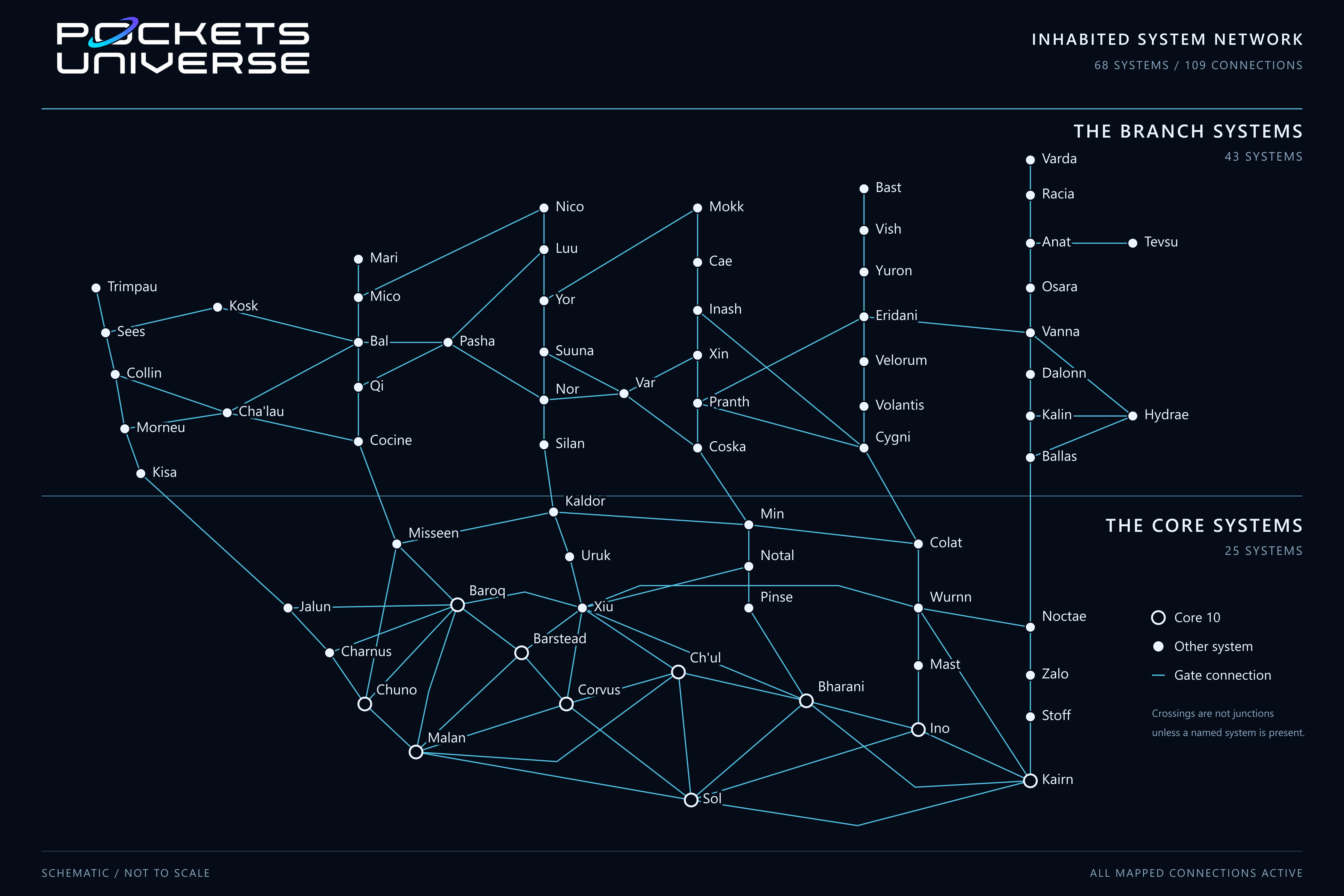
Hover over a system or focus its marker with the keyboard to see its region, population, government and gate neighbors. Click or tap to keep the profile open, then follow its link to the full system article. Press Escape or use the close button to dismiss it.
Use the zoom controls and scroll the map to explore crowded areas. The system selector locates any of the 68 systems directly.
Reading The Network
The map preserves all 109 mapped connections. Hollow circles identify the ten Core 10 systems; filled circles identify other Core and Branch systems. Selecting a system highlights its direct connections and neighbors. Crossings are not junctions unless a named system is present.
The arrangement is schematic, not a physical distance scale. Connection lines represent paired one-way gate services. See Gates and communications for how gate travel works, Star map for the static map, or browse the systems atlas.